


Precinct 17A, Beauregard Parish, Louisiana
About
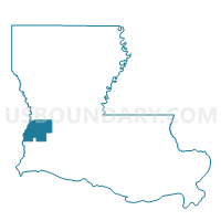
Outline

Summary
| Unique Area Identifier | 588001 |
| Name | Precinct 17A |
| County | Beauregard Parish |
| State | Louisiana |
| Area (square miles) | 2.54 |
| Land Area (square miles) | 2.52 |
| Water Area (square miles) | 0.02 |
| % of Land Area | 99.17 |
| % of Water Area | 0.83 |
| Latitude of the Internal Point | 30.84489820 |
| Longtitude of the Internal Point | -93.17311770 |
Maps


Graphs
Select a template below for downloading or customizing gragh for Precinct 17A, Beauregard Parish, Louisiana


Neighbors
Neighoring Voting District (by Name) Neighboring Voting District on the Map
- Precinct 17, Beauregard Parish, LA
- Precinct 18, Beauregard Parish, LA
- Precinct 19A, Beauregard Parish, LA
Top 10 Neighboring County Subdivision (by Population) Neighboring County Subdivision on the Map
- District 5, Beauregard Parish, LA (4,313)
- District 3B, Beauregard Parish, LA (2,900)
- District 3A, Beauregard Parish, LA (2,531)